In a statement to The Star in response to NRES' claim that the poor collection of geomatics data is costing the government “millions” (www.thestar.com.my/news/nation/2024/10/03/poor-collection-of-geomatics-data-costing-government-039millions039-says-nres), the geomatics professionals under the ambit of the Institution of Geospatial and Remote Sensing Malaysia (IGRSM) said the suggestion by the regulators that the local geomatics industry is suffering from significant data collection failures is a very broad claim that needs to be proven.
"The statement also implies that restricting geomatic surveys to only Licensed Land Surveyors (LLS) will remedy this issue. Interestingly, the Natural Resources and Environmental Sustainability Minister did not address this (data quality) as the major issue for the amendments when tabling the amendment bill in the Dewan Rakyat on March 25," said IGRSM president, Prof Abdul Rashid Mohamed Shariff.
Firstly, the community said it is incorrect, if not unfair, to paint a picture where the industry is rife with questionable standards.
"It is important to recognise that many geomatics professionals across various sectors consistently produce high-quality work, contributing positively to national projects. To generalise based on an isolated incident risks unfairly undermining the contributions of the wider geomatics community. While we acknowledge that no industry is without occasional setbacks, it is important to distinguish isolated incidents from systemic issues. Most geomatics professionals continue to deliver exceptional work across a wide range of projects, adhering to strict professional standards. We are committed to maintaining and improving these standards through ongoing professional development and collaboration with regulatory bodies regarding these claims and their implications," said the statement.
IGRSM has nearly 1,000 professionals as members, all of whom are subject to established procedures for investigation and disciplinary action, including termination of membership where warranted.
"As professional organisations, we maintain the highest standards of practice. We do not tolerate unprofessional conduct or substandard results. In cases where complaints are lodged against our members for incompetence or poor execution, we have established investigation procedures. While we are committed to maintaining these high standards, using isolated incidents to justify restricting the entire geomatics industry to LLS alone is unjust. LLS has also committed professional misconduct in the past, and it was due to this that the current amendments resulted in higher penalties against them. To punish the entire profession of non-LLS geomatic practitioners due to the perceived mistakes of a few will be wholly unfair as similar treatment is not meted on to the LLS.
"We would like to ask how many of the 456 LLS who are currently active are competent to carry out 'laser imaging, detection, and ranging' (LiDAR) surveys. If not all of them are competent in this field, what is the rationale for licensing them to be competent to conduct LiDAR and all geomatic surveys under the amendment?" said ISRSM.
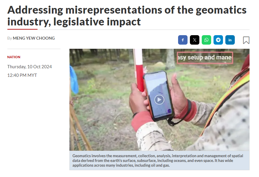
LiDAR is a method for determining ranges by targeting an object or a surface with a laser and measuring the time it takes for the reflected light to return, making it a powerful tool for terrestrial, airborne, and mobile applications," said IGRSM.
The geomatics community also said that during a courtesy visit to the Director General of the National Mapping and Survey Department (Jupem) in June 2018, who is also the chair of the Land Surveyors Board, no concerns were raised regarding the issue of poor geomatics data collection.
"This issue was also not raised in the Jupem DG’s keynote address at the 10th IGRSM International Conference and Exhibition on Geospatial & Remote Sensing (IGRSM 2020).
"We have always been open to collaboration with Jupem and other authorities to address challenges in the geospatial industry and advance the sector. Unfortunately, the opportunity for dialogue on these matters has not been fully utilised," read the statement.
The community also bemoaned the apparent lack of consultation with them when NRES, through the Land Surveyors Board, conducted an online survey under the auspices of the Malaysia Productivity Corporation portal from Dec18, 2020, to Jan 15, 2021, before the tabling of the amendment to the Licensed Land Surveyors Act 1958 (also known as Act 458). The amendment will restrict the field of geomatics to only LLS registered under the Land Surveyors Board.
"During our own discussions in June and July 2024 with 41 relevant stakeholders, 38 of them stated they were unaware of the amendment and were not informed or invited to LJT’s sessions in 2020, despite the significant impact on their industries. The absence of these stakeholders from the consultation process raises serious concerns about how their input was considered. The other three organisations, the Board of Engineers Malaysia (BEM), Board of Architects Malaysia (BAM), and Board of Town Planners Malaysia (LPBM), confirmed their involvement but did not support the amendment as approved.
"All 41 stakeholders also reported receiving no notice of the MPC survey, further questioning the transparency and inclusiveness of the process," said the affected stakeholders, who also could not obtain any minutes or reports arising from the Malaysian Productivity Corporation's engagement sessions, despite having made a formal request.
The stakeholders also called for more clarification on what constitutes a "survey-accurate technique" and its broader implications.
"We would like to respectfully address the statement by the Natural Resources and Environmental Sustainability Minister in the Dewan Rakyat on March 25 regarding the definition of 'survey-accurate technique'. While the Minister mentioned that this term refers to precise measurement methods using equipment such as GPS and total stations, it is imperative to note the significant differences between this explanation and the definition provided in the draft regulations presented by the Land Surveyors Board during the town hall on Sept 9 (after the passing of Act 458).
"The draft regulations define survey-accurate technique as a comprehensive process that encompasses determining various aspects of the earth's surface and obtaining plans based on standards set by the Director General of Jupem. The definition gives neither accuracy nor technique and seeks to encompass virtually all geomatic surveys, whether conducted on land, water, natural and artificial features, and above, on and below the Earth's surface. Hence, the Minister’s explanation emphasising precise measurement methods with specific equipment may not fully encompass the broader scope outlined in the regulations.
"Furthermore, equipment such as GPS and total stations are widely utilised across various professions, including civil engineering, hydrography, environmental science and urban planning, rather than just by LLS. Attempts to limit or prevent its use are counter-intuitive and against the developing trend of modern technology. For example, GPS can be used for the layout and replanting of tree crops, such as seen here: www.youtube.com/watch?v=tptWIj63HG4&t=4s. Will users of such technology be breaching the law?" said the geomatics professionals, who added that there has also been a misrepresentation of the amendment's impact on various fields.
"The assertion (by the authorities) that fields such as engineering, geology, hydrography, town and country planning, construction, air traffic control, and marine navigation are not impacted because they do not use survey-accurate techniques is inaccurate.
"In many of these fields, professionals regularly rely on precise geomatics data, often requiring high accuracy. For example, engineering and construction projects demand highly accurate airborne, terrestrial and topographic surveys, while hydrography and marine navigation depend on precise positioning for safety and operational efficiency. Similarly, reliable geomatics data is important for fields such as geology, town and country planning, forestry, agriculture, plantation, landscape architecture, as well as other sectors for applications such as site assessments, land use planning, resource management, environmental impact studies and sustainable development practices. The notion that these fields do not require survey-accurate techniques underplays the critical role that accurate geomatics data plays in their operations.
"Moreover, according to the draft regulations, data capture activities such as airborne, terrestrial and topographic survey and mapping, as well as survey and mapping for Building Information Model (BIM) and Geospatial Information System (GIS), are now restricted to only LLS, which directly impacts the ability of professionals in these sectors to carry out their work. Non-LLS geomatics professionals, even those with years of experience, would face barriers in conducting geomatics surveys essential to their fields, thus hindering their ability to operate effectively. The broad wording in the legislation has already been arbitrarily interpreted at the town hall (on Sept 9) and the statement by NRES. It risks imposing unnecessary restrictions on a wide range of sectors that traditionally and competently manage their own geomatics data requirements, which could lead to inefficiencies and additional costs without any demonstrable benefit to the accuracy or quality of the work," said the affected stakeholders.
They added that while the NRES statement asserts that the legislation will align Malaysia’s geomatics sector with global advancements, it fails to specify which countries or global standards are being referenced.
"This vague statement raises the question of how this alignment is being measured and which benchmarks are being used. During the meeting with the NRES Secretary-General on June 11, we inquired about this, and the response from LJT was that no benchmarking was done against any other country, but it does not mean that Malaysia should follow them by not having one. Without specific examples or benchmarks, it is difficult to evaluate the relevance and validity of the claim.
"In conclusion, the response from NRES not only misrepresents the scale of the issue but also fails to acknowledge the contributions of non-LLS geomatics professionals across various sectors. The proposed changes and their potential impacts should be reconsidered, with genuine consultation from all affected stakeholders to ensure a fair and inclusive outcome," said the stakeholders, who expressed their commitment to meaningful engagements.
"We remain open to engaging in constructive dialogue with NRES, LJT and Jupem to address these concerns. Our goal is to collaborate in finding solutions that uphold the integrity of the geomatics industry while ensuring that all qualified professionals can continue contributing to the development of the industry and the nation," they said.
The amendment to Act 458 is expected to be gazetted soon, following Royal Assent on July 2.