
THE recent sinkhole incidents, including the tragic case at Jalan Masjid India and the sinkhole found at KLIA's Bunga Raya Complex, highlight the need for better management of underground systems.
This is why the deputy works minister's announcement that all public and private sector construction projects worth RM10 million and above are to adopt Building Information Modelling (BIM) is a step in the right direction.
BIM, while often used for buildings, can also give a better understanding of what is happening underground by creating 3D models of pipes, sewage systems and other critical infrastructure.
To make these models more effective, BIM can be combined with other tools like Geographic Information Systems (GIS) and ground-penetrating radar. These technologies can help to map out underground systems accurately, even for older infrastructure that was not originally designed using modern tools.
However, creating a static 3D model is not enough. This is where Digital Twin technology comes in. A Digital Twin is like a live, virtual copy of the infrastructure, updated in real-time by data from sensors placed throughout the underground system.
For example, if a pipe starts to develop a leak or weaken, the sensors will detect it, and the Digital Twin will alert engineers to the issue before it gets worse. This means we can fix problems early and reduce the chance of sinkholes forming.
In addition, artificial intelligence (Al) adds another layer of safety by analysing all this data to predict future problems. Al can look for patterns, such as when certain pipes or areas are likely to fail, and suggest preventive actions to stop major incidents like sinkholes from happening in the first place.
GIS is also a key tool that helps us see the bigger picture. It provides important information about the environment around the infrastructure. such as soil conditions. water flow or even about the environment around the infrastructure, such as soil conditions, water flow or even how much traffic passes over certain areas.
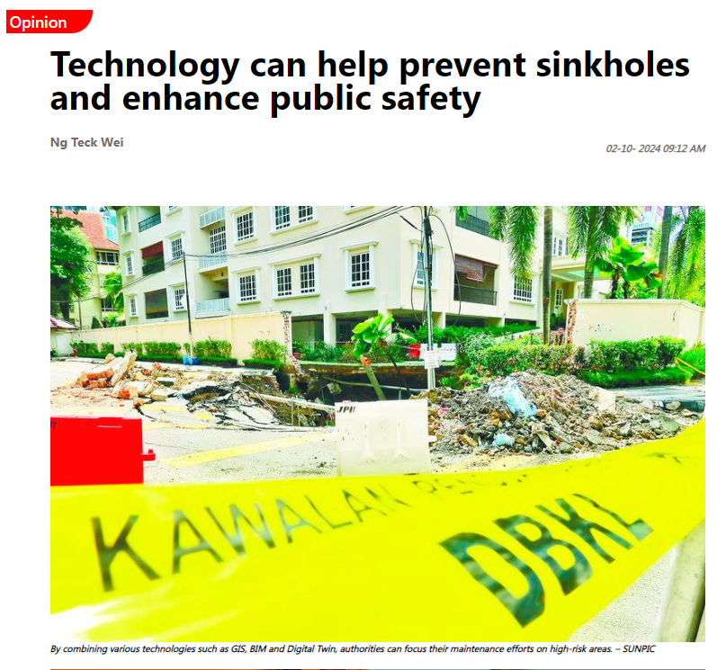
By combining GIS with the insights from BIM and the Digital Twin, authorities can focus their maintenance efforts on high-risk areas.
Usage of these technologies is the way forward to ensure best practices and safety in the construction industry in the county. It is encouraging that the government is also exploring Al and other digital tools across various industries, including infrastructure.
With a collective effort and continuous commitment to safety, these technologies can greatly improve how we manage infrastructure, prevent sinkholes and enhance public safety while strengthening the durability and resilience of our systems.
This article is contributed by Ng Teck Wei, an associate dean of the Department of Construction Management, Faculty of Built Environment at Tunku Abdul Rahman University of Management and Technology.
and other digital tools across various industries, including infrastructure.
With a collective effort and continuous commitment to safety, these technologies can greatly improve how we manage infrastructure, prevent sinkholes and enhance public safety while strengthening the durability and resilience of our systems.
This article is contributed by Ng Teck Wei, an associate dean of the Department of Construction Management, Faculty of Built Environment at Tunku Abdul Rahman University of Management and Technology.
Comments: This email address is being protected from spambots. You need JavaScript enabled to view it.
